Last Updated: 13th Jan 2026
Pelorus Loop Track
Last Updated: 13th Jan 2026
Open
Grunt Factor: 74 ?
Gnarl Factor: 70 ?
38.5km
2110m
2110m

Last Updated: 13th Jan 2026
Last Updated: 13th Jan 2026
Open
Grunt Factor: 74 ?
Gnarl Factor: 70 ?
38.5km
2110m
2110m
Front country - easily accessible
Loop
Undulating, some big hills
Native bush
Plantation/exotic forest
Riverside
Lakeside
Open farmlands
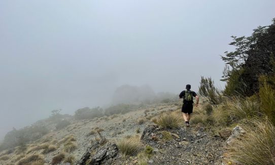
Open tussock/grasslands
Open ridges/tops
Easy Single Track
Moderate Single Track
Technical Single Track
Average Uphill Gradient: +11.60%
Average Downhill Gradient: -11.50%
VIP Feature: Send this route to your Garmin account so you can follow the course on your Garmin device.
Become a VIP Member to see the trailhead information.
8:00
Slow
6.5:00
Moderate
5
Fast
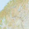
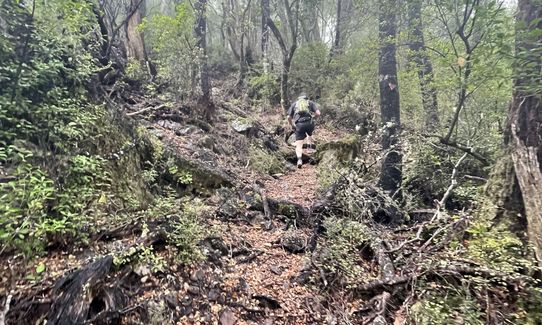
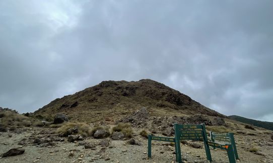
Beginning at the car park run up to Maungatapu saddle up to the top of mount Maungatapu. Run along to Dew lakes then up Little Twin and Dun Mountain. There you will get to view the Dun Mountain emergency shelter.
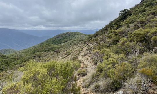
Continue running to Rocks hut to Middy Hut and then to Captains Creek Hut. From Captain Creek hut run along and down and past the beautiful Emerald Pools. From the Emerald Pools run back to the car park.
This trail includes the peaks Dun Mountain and Maungatapu.
If you know of any public toilets near the trail start or on the route, please login and then let us know so we can update this section.
Lots of parking available.
76 km
95 minutes
Unknown
No
Moderate.
Orange markers lead the whole way through.
Non-existent.
Waterproof leggings, Thermal leggings, Seam-sealed waterproof jacket, Windproof jacket, Whistle, First aid kit, Extra food for emergencies, Survival blanket, Cellphone, Compass, Map, Headtorch and spare batteries, Crampons / microspikes (for winter conditions)
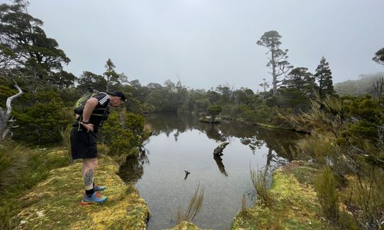
There is available water at Rock hut which is drinkable. The rest of the route look for small creeks which are available along the way. Ideally bring a filter.
Exposed to cold winds and snow
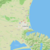
Pelorus Cafe
Pelorus Bridge
Do you have another suggestion on where to go afterwards for the best coffee / cake / breakfast / brunch / beer?
Trail Legend
Login as a VIP to become a Trail Legend. Learn about Trail Legends.
Fastest Known Times (FKTs)
You and Pelorus Loop Track
As a VIP member you can record private notes for this trail, see all of your times and more.
Already have an account? Login now
Pretty epic for most of it. But the tree roots get a bit annoying for the last 20km.
November 22
These overlap with this trail to some degree. You may wish to combine them but please note that to qualify for FKTs on these runs you should record a separate activity for each.
Send to your phone
Scan the below QR code to open this trail on your phone.

Tip: position the QR code in your phone camera screen.
Plan smarter, stay motivated, track your progress, and unlock the full Wild Things experience — while saving along the way.